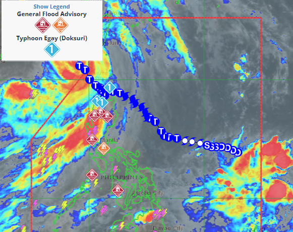
The Philippine Atmospheric, Geophysical and Astronomical Services Administration, said Typhoon Egay is now out of the Philippine area of responsibility while a new tropical cyclone is likely to hit the country.
PAGASA said ‘Egay’exited PAR at 8 a.m. and was on its way to the Taiwan Strait and China. It was last tracked over 255 kilometers west of Itbayat, Batanes, packing maximum sustained winds of 150 kilometers per hour near the center and 185 kph gusts.
Meanwhile, PAGASA said it now monitoring another tropical cyclone, which was last tracked 1,585 km east of Eastern Visayas still outside PAR and it “has no direct effect on any part of the country yet.”
The tropical cyclone may enter PAR between Saturday night and Sunday.
PAGASA said the Tropical Cyclone Wind Signal No. 2 is still hoisted over Batanes, the northwestern portion of Cagayan (Claveria, Santa Praxedes) including Babuyan Islands, and the northern portion of Ilocos Norte (Pagudpud, Adams, Bangui, Dumalneg, Burgos).
These areas may experience flooding, especially in low-lying areas. Strong winds could damage old and light materials amid inclement weather.
TCWS No. 1 is raised over the Pangasinan, La Union, Ilocos Sur, the rest of Ilocos Norte, the rest of Cagayan, Apayao, Kalinga, Mountain Province, Ifugao, Abra, Benguet, Isabela, Quirino, Nueva Vizcaya, northern portion of Aurora (Casiguran, Dinalungan, Dilasag), northern portion of Nueva Ecija (Cuyapo, Guimba, Pantabangan, Science City of Muñoz, Carranglan, San Jose City, Lupao, Nampicuan, Talugtug), and the northern portion of Tarlac (Paniqui, Moncada, Pura, Camiling, Ramos, San Manuel, Anao, San Clemente).
PAGASA said heavy rainfall will prevail over Ilocos Norte, Ilocos Sur, La Union, Batanes, and Babuyan Islands with flooding and rain-induced landslides highly likely, especially in areas highly susceptible to these hazards.
Further, the southwest monsoon or ‘habagat’ enhanced by Egay will continue to cause occasional monsoon rains over the western portions of Central Luzon and Southern Luzon in the next three days.
Areas in Luzon and Western Visayas that are not under any signal will continue to experience gusty conditions due to the southwest monsoon.
PAGASA said sea travel remains risky for most vessels as rough to very high seas continue to prevail over several seaboards of Luzon and the eastern and western seaboards of the Visayas.
All mariners to remain in port or seek safe harbor until winds and waves subside.###
